
Well-Signposted Trails for Walkers
Walks through the Rio Lobos Canyon
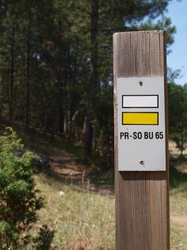
Footpaths crisscross the entire natural park, and many short-distance walks have been signposted with the characteristic white and yellow stripes. However, the four main trails described on this page will take you through the most relevant areas of the park and are more than sufficient to get a good taste of the local scenery and ecosystems.
Below you will find a short presentation of each of these four trails, along with a link to .pdf files containing our scans of the very interesting and well-illustrated field guides published by the park management (unfortunately only available in Spanish).
If a serious walk isn't really what you're looking for, the short and gentle stroll to Saint Bartholomew's chapel (as described on the previous page "standard visit") is a thoroughly recommendable and sufficiently rewarding alternative for most visitors.
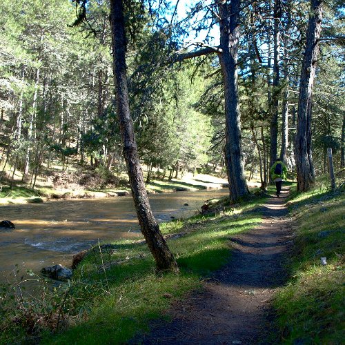
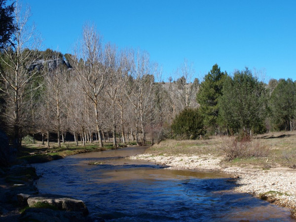
1. River Trail
25 km in each direction
divisible in different sections
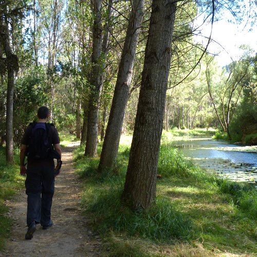
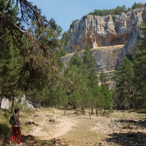
The River Trail follows the course of the river Lobos from one end of the natural park to the other, covering the 25 km that separate the Roman bridge at Hontoria del Pinar in the province of Burgos from the source of the river Ucero at the bottom end of the Canyon in Soria province. This is undoubtedly the main walking route in the park, in terms of both length and popularity, and because it takes you through the very heart of this protected natural area, the canyon itself.
There are a number of access points to this footpath, not only its two ends, making it easy to split the route into shorter sections. Access can be had at the "Puente de los Siete Ojos" (the 7-span bridge) about halfway along the canyon, and vehicle access to the carpark at Valdecea means you can also potentially skip the first three kilometres. Obviously you don't have to walk the entire length of the trail, but just do the section you want, knowing the distance you've got to walk back to your starting point. With its twists and turns, the view changes considerably depending on which direction you're walking in, and even though you're going back the same way you came, you get the feeling that it's somewhere new.
The footpath is very well signposted and simple to follow. The ground can be a little irregular, stoney or muddy in some places, but with a good pair of walking boots that should be no problem. The trail constantly crosses from one bank to the other via uneven stepping stones, which may be a challenge to some walkers.
It is important to note that spring flooding can sometimes make the river impassable, and certain parts of the canyon may become inaccessible. If in doubt, check with the park office before setting out. Having said that, for most of the year the Lobos is an underground river, and the riverbed is usually dry upstream of Pozo Perín, and downstream of this point consists of a string of lily ponds connected by just a trickle of water.
The attached field guide (Spanish only) has well-illustrated detailed information about this walk, but we'd like to add three recommendations of our own:
(1) At the Ucero end there are three car parking areas inside the canyon: Fuente Engómez, Cueva Fría and Valdecea. It is tempting to drive on to the last car park and start walking from there, but if you do this you will miss out on a couple of km of spectacular rock walls, which are best seen on foot.
(2) Beyond St Bartholomew's chapel, in the area known as the Castillo Bellido reserve, the scenery is especially pretty for five or six kilometres up to Pozo Perín. After this point the landscape flattens out and turns into less dramatic woodland between here and the Puente de los Siete Ojos. This may be a good point for you to turn back towards Ucero, and save your energy for a walk up to Ucero castle.
(3) At times (some weekends, Easter, October bank holiday, mid August) the area around St Bartholomew's chapel can become excessively congested with visitors. Despite being a fragile natural site, the park's management currently sets no limits on visitor numbers. If you wish to avoid the crowds, one option may be to follow the River Trail upstream of the Puente de los Siete Ojos. This is a much less frequented area, but also thoroughly charming and packed with spectacular rock walls and plenty of bird life. It is also a little shadier in summer.
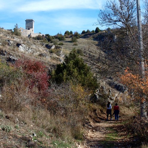
2. Castle Trail
Circular 6.5 km
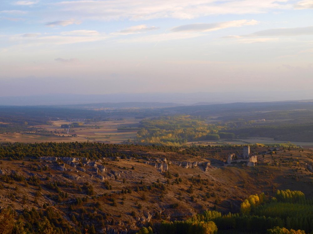
Of the four main walking routes described on this page, the Castle Trail is the only one that does not pass through the canyon itself. This is a circular route that winds around the upper course of the river Ucero, between the source of the river and the village of Ucero. Along the way it takes in Ucero castle, which is freely open to visitors, and passes through a Roman tunnel that formed part of a system which delivered water to the Roman town of Uxama 20 km away.
There are several places along this circular route where you can park your car and start to walk, but we would suggest taking the visitor centre (Casa del Parque) as your starting point, and urge you not to miss the interesting exhibition about the park's wildlife and natural setting. The attached field guide describes the route in clockwise direction, but we tend to think it's better in anticlockwise direction (the views are better).
This is the shortest of our four routes but is very diverse and has plenty of interest. It is a quieter alternative to the hustle bustle of the chapel area on a busy day. But above all it offers spectacular views from Ucero castle looking towards the canyon and the Galiana pass. We think it's an excellent choice to see the park from a different angle or to extend and complement a visit to Ucero castle.
The walk takes about two hours, plus however long you spend looking around the castle, and is quite easy, apart from the stiff climb up the castle hill. The route actually passes through a Roman tunnel which is 133 m in length. This is quite fun, and from one end of the tunnel you can see the light at the other end, but if you do suffer from claustrophobia you can skip this part of the route and take a short cut up to the castle directly from the river bridge in Ucero. We should also point out that the trail crosses the river Chico, which is a dry rock-strewn area most of the year round, but at rainy times may be a small obstacle (look upstream to find an easier place to cross).
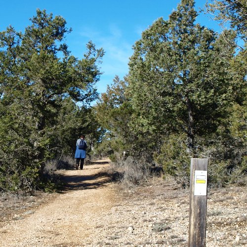
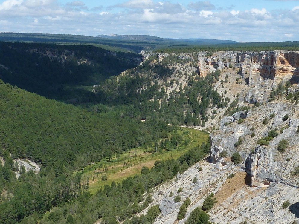
3. Gullurías Trail
Circular 9 km
The Gullurías Trail is another circular walk, in this case comprising a distance of 9 km, with its starting and finishing point at the Casa del Parque visitor centre close to Ucero. The name of this trail refers to the Gullurías viewpoint, which can only be reached on foot, where we can enjoy a good panoramic view of the canyon and the forests and mountains beyond. "Gulluría" is a local name for the wood lark.
Another attraction of this walk is that the first few kilometres pass through the harsh dry upland scrub known as "paramera", where incense junipers, rock roses and aromatic herbs are the only plants that can thrive on the poor thin soil and dry rocky substrate. Here we get good views to the south, looking out over the Douro depression to the Sistema Central mountains 60 km away, and then north to the Sistema Ibérico mountains 30 km away. Later on the trail will take us through some of the park's other characteristic habitats, such as pinewoods, riverside woodlands and poplar plantations, giving us a good idea of its diversity.
After visiting the viewpoint the path runs downhill through a shady gulley full of pine saplings to the canyon floor, just 500 metres downstream of St Bartholomew's chapel. The circular route now turns downstream, following the course of the river Lobos, but you may wish to walk upstream a little to see the famous chapel and perhaps even go beyond, before heading back towards Ucero. The return leg takes us past the car parks at Valdecea, Cueva Fría and Fuente Engomez before emerging from the canyon at the road bridge just where the river Lobos runs into the main source of the river Ucero.
Thanks to improvements that have been made in recent years, the way back from here to the visitor centre runs along a well signposted new footpath that skirts the campsite, crosses the irrigation canal and takes us through cool poplar woods, so it is no longer necessary to walk along the roadside as indicated in the attached field guide (which was first published more than 20 years ago).
This route offers little difficulty for any able-bodied walker, once we have overcome the steep climb up from the visitor centre at the beginning of the walk. During the rainy season, when the stepping stones that cross the river Lobos are lost under water, the Gullurías Trail is the only way to reach St Bartholomew's chapel on foot, following the footpath out and back across the upland scrub. Another interesting option is to combine the Gullurías Trail with the Castle Trail to make a larger circular route starting and ending at the visitor centre.
4. Hontoria Trail
Circular 10 km
At Hontoria del Pinar, in the province of Burgos, the river Lobos starts to cut its way into the limestone plateau that comprises the Rio Lobos Canyon Natural Park, gradually deepening and widening the course of the river. The landscape at this upper end of the canyon is very different to the high rock walls that characterise its final stretch close to Ucero. Here the river flows through dense pine woods, punctuated from time to time by small rocky outcrops shrouded by the trees. This part of the park is more primitive, more intimate, and less frequented, but equally recommendable.
The Hontoria Trail is another circular walk of little more than 10 kilometres in length which runs along this upper section of the river Lobos, up to the spot known as La Isla. At this point we take a side turning away from the river, climbing up to the incense juniper woods of El Hocino, and then head back to Hontoria via a steep gully which brings us down to the famous Roman bridge and returns us to our starting point.
Shortly after leaving Hontoria we see how the river is swallowed up into the ground, and except in winter/spring the river nearly always runs dry from here onwards. After having visited this part of the park on many occasions, and at different times of the year, we can safely say that with water it is all so much prettier, as the river babbles along through the forest.
If you are doing this walk in the rainy season, or shortly after a period of heavy rainfall, you may be lucky enough to see water gushing out of the ground at the springs known as Las Raideras. These are situated just slightly downstream of La Isla, so you will have to take a small detour away from the circular route, going on along the river for a few hundred additional metres and actually crossing a couple of times. However, to see these springs in action there really needs to be a lot of water about, and it may be challenging getting across the river at the stepping stones by La Isla. Not that you'll be swept away, but you might get wet feet!
Leaving the river behind, the trail rises up through lovely pinewoods to the meeting point of several paths at Tres Vallejos. To go on to Hontoria we should follow the path that takes us through the juniper woods of El Hocino. But there is also another option, which means lengthening our route by about 5 km in order to visit one of the most charming spots in all the natural park: the Costalago viewpoint. To get there we need to follow the signposts to La Sierra / EL Portillo Ancho. From there on the trail back to Hontoria is a well signposted variant of the PR-BU5.